Tasmania Stanley to Bruny Island

Australia Map | Home Page 1 of 4 | Page Down

We arrived along with the baton having it's last hurrah before being handed to the 'Sulphur Crested Monarch' as she was dubbed by the press because of her white hat with bright yellow trim.  Along with hundreds of the 4000 Ulysses biker club members, motto "Growing Old Disgracefully" meeting and touring Tassie this week.  We saw them everywhere,  happily living up to their motto

Stanley Old Pioneer Burial Ground 1828

I'm sure one could rest in peace between the ocean and the Nut

We drove straight to Stanley, found a campsite and set off to climb the 150 meters to the top of The Nut an ancient volcanic plug

As we climbed the good old boys of Ulysses took the cable car, disgracefully

Due to the Easter holidays and the fully booked camp grounds we spent a lot of time in the car looking for somewhere to lay our heads
Pipes coming down from the power station from Lake Margaret Dam Queenstown


The scenery was spectacular around Queenstown in the late afternoon light but not very accessible from the twisty narrow roads and we didn't have time to linger
   

This gem of a site has no showers, camp kitchen etc, just a beautiful location.   Working on the honesty system campers deposit their $5 overnight camping fee in the box provided

Camp Companion 'Maggie' the first of many  

 A storm the next night had us rethinking our decision to take the ferry to Bruny Island but Tony could see traces of blue in the sky so we went.  We quickly realised we had grossly underestimated the time we would like to spend on Tassie, our first priority was to arrange a later crossing back to Melbourne, we could have one 2 days or 2 weeks later.   We reluctantly accepted the former

Bruny Island

Able Tasman failed to land here in 1642 and it was left to Rear Admiral Bruni D'Ebtrecasteayx to explore and survey the island in 1792.  It still bears his name

There was sealing and whaling here but the modern world passed Bruny by until the ferry service began in 1954

Most visitors come on day trips from Hobart, few staying overnight.   There were self contained cottages, guest houses and of course campsites.   Bruny really merits more than a day trip


The Neck

Geologically two landmasses - North and South Bruny joined by a narrow isthmus, known locally as "The Neck".  There is a timber stepped boardwalk to the Truganini Lookout that allows you to access a spectacular panoramic view of the coastline


The walk along the Fluted Cape is only 3.5km but straight up.  I did the whole walk clutching the lovely skeleton of a sea dragon.  I took it back to camp to show the party of schoolchildren who had just arrived, then returned it to the beach

Some of these photos were taken with one arm clutching a tree, no better than the people who fall to their death taking selfies, just luckier 


Thanks to Peter Brindley, Marketing Dept Bruny Island for permission to use this image https://brunyisland.com.au/

We enjoyed 
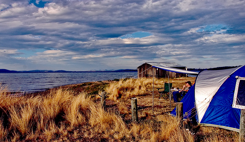
our stay at Captain James Cook Campground  very much.  On our last day the manager suggested an early evening stroll to a nearby 
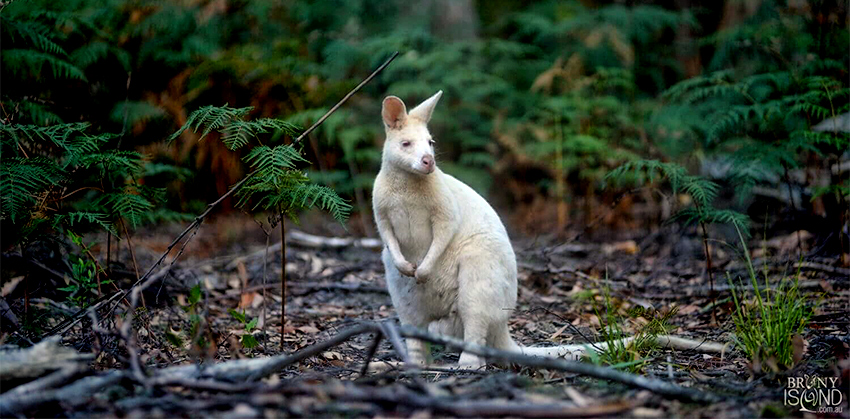
field where we would see white wallabies

A rare genetic mutation in the Bennett's Wallaby has resulted in their snow white fur, some are albino and also have pink eyes, ears and noses 

 They survive in the wild here because of the lack of predators and the fact they are so darned cute

Tasmania, a producer of opium has many poppy fields.   The wallabies of Bruny have been known to invade the fields to get high as kites and wander around under the influence, leaving telltale crop circles

Australia Map | Home Page 1 of 4 | Page Down